Pharmacy nearby Pharmacie Lope De Vega
Morocco
Pharmacy nearby Pharmacie Lope De Vega
Pharmacie Lope De Vega
Hay Al Matar, Nador, Marruecos
contacts phone
:
+212
Latitude:
35.1500893
, Longitude:
-2.9229027
larger map & directions
read more
nearest Pharmacy
337 m
Pharmacie Talbi
Hay Al Matar, Nador
Pharmacy
read more
447 m
The new pharmacy Nador
N19, Nador
Pharmacy
read more
670 m
adam
ADAM A COTE DE MOSQUEE ASOUNA ENTOURANT DE CAFE OCCIANO, Nador
Pharmacy
read more
930 m
pharmacie Almatar
Nador
Pharmacy
read more
1.365 km
Pharmacie NADOR
Nador
Pharmacy
read more
1.569 km
Pharmacie AJWAW
Nador
Pharmacy
read more
1.606 km
Pharmacie Granada
Avenue Taouima, Nador
Pharmacy
read more
1.732 km
PHARMACIE LAARASSI
Avenue Sidi Mohammed, Nador
Pharmacy
read more
1.975 km
Pharmacie ouaaliti
Nador
Pharmacy
read more
2.121 km
pharmacie ALHILAL
414 Avenue Almassira, Nador
Pharmacy
read more
2.122 km
Pharmacie OLAD LAHCEN
Nador
Pharmacy
read more
2.369 km
Pharmacie TANOUTI
Nador
Pharmacy
read more
2.456 km
صيدلية البحر الابيض المتوسط Pharmacie
Nador
Pharmacy
read more
2.57 km
World Pharmacy
Nador
Pharmacy
read more
2.589 km
Pharmacie Baraka
Rue Baraka, Ouled Mimoun, Nador, Nador
Pharmacy
read more
2.693 km
صيدلية أبلانكو
Nador
Pharmacy
read more
2.753 km
Pharmacie Ouled Mimoun
BV Aoulad Mimoun, Nador
Pharmacy
read more
2.773 km
Pharmacie Al amine - صيدلية الامين
Nador
Pharmacy
read more
2.845 km
Pharmacie صيدلية
Nador
Pharmacy
read more
2.885 km
Pharmacie Ichomay
Nador
Pharmacy
read more
2.898 km
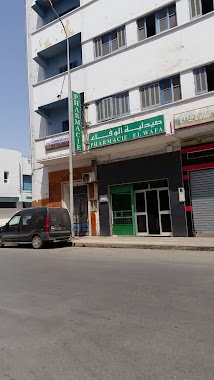
Pharmacie WAFA
Nador
Pharmacy
read more
3.017 km
Sun Pharmacy صيدلية شمس
Nador
Pharmacy
read more
3.047 km
Pharmacie HASSANI
Nador
Pharmacy
read more
3.369 km
صيدلية إيكوناف
Nador
Pharmacy
read more
3.392 km
Pharmacie Makkah
Nador
Pharmacy
read more
📑
all categories
Accounting
Administrative area level 1
Administrative area level 2
Airport
Amusement park
Aquarium
Art gallery
Atm
Bakery
Bank
Bar
Beauty salon
Bicycle store
Book store
Bus station
Cafe
Campground
Car dealer
Car rental
Car repair
Car wash
Cemetery
Church
City hall
Clothing store
Colloquial area
Convenience store
Courthouse
Dentist
Department store
Doctor
Electrician
Electronics store
Embassy
Establishment
Finance
Fire station
Florist
Food
Funeral home
Furniture store
Gas station
General contractor
Grocery or supermarket
Gym
Hair care
Hardware store
Health
Home goods store
Hospital
Insurance agency
Jewelry store
Laundry
Lawyer
Library
Light rail station
Liquor store
Local government office
Locality
Locksmith
Lodging
Meal delivery
Meal takeaway
Mosque
Movie rental
Movie theater
Moving company
Museum
Natural feature
Neighborhood
Night club
Painter
Park
Parking
Pet store
Pharmacy
Physiotherapist
Place of worship
Plumber
Point of interest
Police
Post office
Premise
Real estate agency
Restaurant
Roofing contractor
Route
Rv park, camping
School
Shoe store
Shopping mall
Spa
Stadium
Storage
Store
Supermarket
Synagogue
Taxi stand
Train station
Travel agency
University
Veterinary care
Zoo
sublocality level 1
↑